

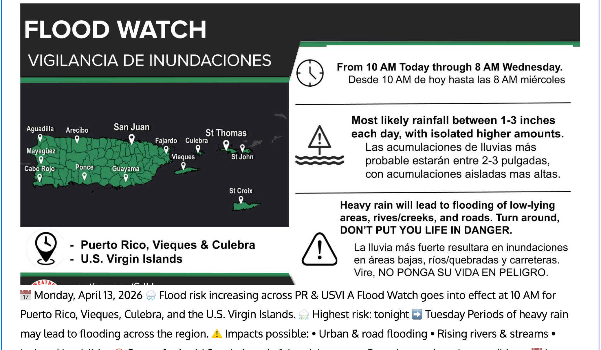
A NWS graphic shows a Flood Watch in effect from 10 a.m. Monday through 8 a.m. Wednesday for PR, Vieques, Culebra, and the USVI, with 1 to 3 inches of rain per day and flooding risks across low-lying areas. Photo Credit: NWS, SAN JUAN.
A Flood Watch remains in effect from 10 a.m. AST Monday through Wednesday morning for portions of Puerto Rico and the U.S. Virgin Islands, as forecasters warn that excessive rainfall could trigger flooding in urban and poor-drainage areas, inundate low-water crossings, and intensify later Monday into early Tuesday. At the same time, the National Weather Service has issued a Marine Weather Statement after Doppler radar detected several clusters of strong thunderstorms over offshore and nearshore Atlantic waters, creating hazardous conditions for boaters.

The flood watch covers portions of Puerto Rico, including the Central Interior, Culebra, Eastern Interior, Mayaguez and Vicinity, North Central, Northeast, Northwest, Ponce and Vicinity, San Juan and Vicinity, Southeast, Southwest, Vieques, and Western Interior.
In the Virgin Islands, the watch includes St. Croix and St. Thomas-St. John and Adjacent Islands.
Forecasters said flooding caused by excessive rainfall continues to be possible from 10 a.m. Monday through Wednesday morning. Impacts could include flooding in poor-drainage and urban areas, as well as flooded low-water crossings.
According to the latest update, the flood threat is expected to increase as a trough continues to approach from the northwest. The heaviest activity is anticipated from later Monday afternoon into the early morning hours Tuesday.
The National Weather Service said confidence is increasing based on the latest guidance and atmospheric setup, although the exact placement of the heaviest activity remains uncertain.
Residents were advised to monitor later forecasts and remain alert for possible Flood Warnings. Those living in flood-prone areas were urged to be prepared to take action should flooding develop.
Separately, a Marine Weather Statement issued at 4:34 a.m. AST Monday warned of several clusters of strong thunderstorms over the waters.
The statement covers Atlantic waters of Puerto Rico and the U.S. Virgin Islands from 10 nautical miles to 19.5N, coastal waters of northern Puerto Rico out 10 nautical miles, coastal waters from Cabo San Juan to the waters between Anegada Island and Virgin Gorda and north 10 nautical miles, and coastal waters east of Puerto Rico, around Vieques, and around and just north of Culebra and Saint John.
At 4:33 a.m. AST, Doppler radar indicated several clusters of strong thunderstorms capable of producing winds to around 30 knots and frequent lightning. The thunderstorms were located mainly over offshore and nearshore Atlantic waters.
Mariners were warned to expect gusty winds to around 30 knots, locally higher waves, and lightning strikes. Boaters were advised to seek safe harbor immediately until the storm passes.


Advertisements